
Bethany ZIP Coverage
Bethany’s defensible primary postal ZIP is 73008. The research also identified 73122, 73127, and 73132 as Census ZCTA or profile overlaps in the wider Bethany area, plus 73099 in an Oklahoma House District 100 ZIP list. Those surrounding codes must not be converted into a claim that they serve every Bethany parcel. Census and political lists describe their own geographies. USPS address verification is the proper way to decide a mailing ZIP for one location.
| ZIP | Relationship to Bethany | Post office reference | Research caution |
|---|---|---|---|
| 73008 | Primary postal ZIP for Bethany city | Bethany Post Office, 73008-9998 | Verify each delivery address through USPS |
| 73122 | ZCTA or profile overlap near Bethany | Oklahoma City-area facilities | Not confirmed as a Bethany city postal ZIP |
| 73127 | West Oklahoma City-area overlap | Oklahoma City-area facilities | Overlap is not municipal or postal proof |
| 73132 | Northwest Oklahoma City-area overlap | Oklahoma City-area facilities | Use USPS for the actual address |
| 73099 | Listed with nearby places in House District 100 | Yukon or area postal geography | A district list is not postal coverage |
ODOT’s current Bethany map lists a 2020 population of 20,831 and shows the city’s roads and limits. That city figure does not turn a ZIP or ZCTA into a resident count. Postal, Census, and municipal lines are separate tools.
Note: The surrounding entries show ZCTA or district overlap, not verified Bethany postal coverage for an individual delivery address.
Bethany ZIP Postal Center
The Bethany Post Office location page identifies the 73008 office as Bethany, OK 73008-9998 at 6612 NW 38th Street. Its published retail hours are Monday through Friday from 8:30 to 5, and Saturday from 9 to 12. PO Box access is listed as 24 hours. Those hours and services belong to the post office listing, not to a blanket rule for every address that uses a Bethany mailing line.
The official Bethany Post Office listing is the source for the 73008 service point and its published access details.
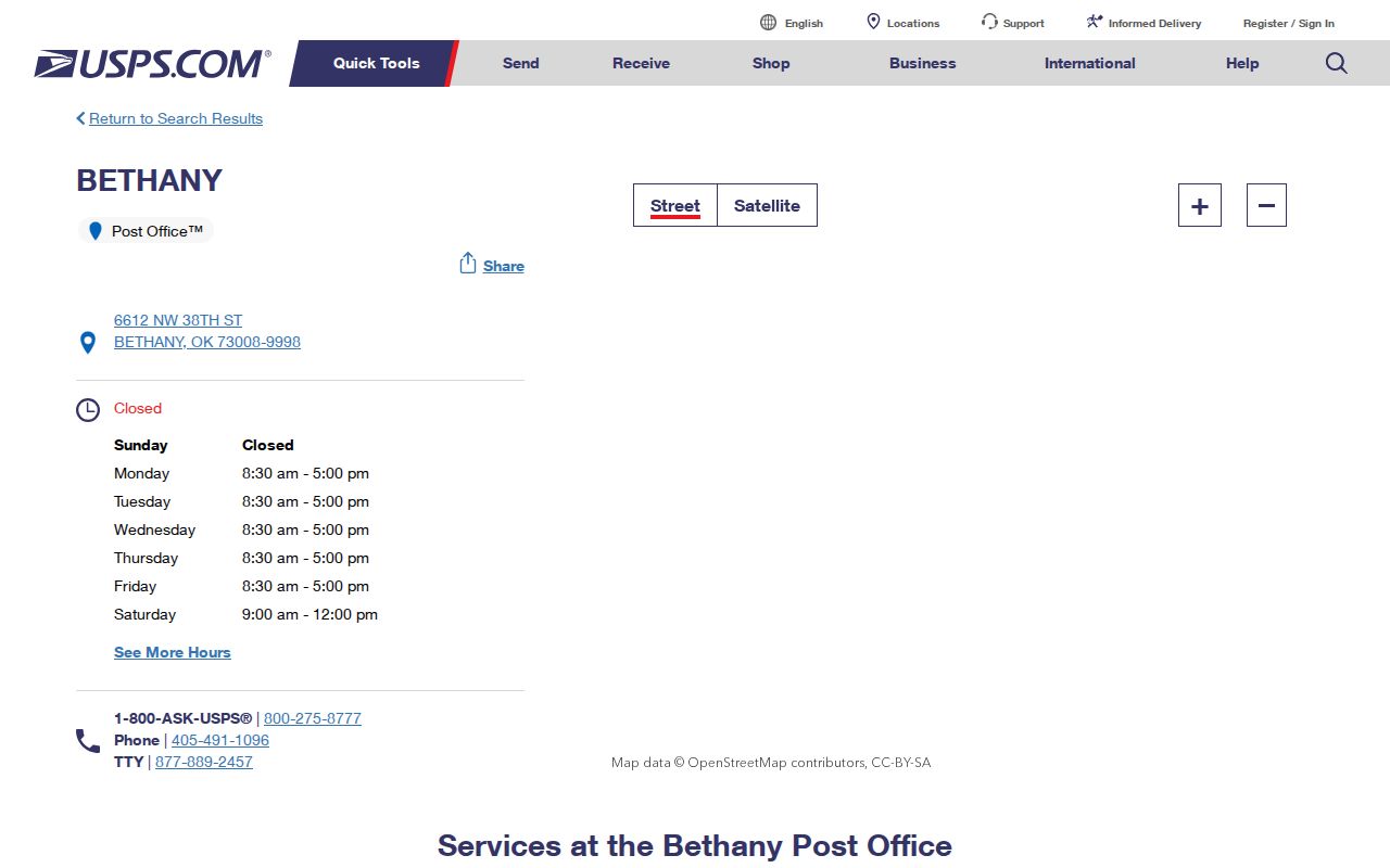
The post office entry supports the 73008 conclusion, while an address-level result remains necessary when a property sits near Bethany’s edges or has a different accepted city name.
Verify Bethany ZIP Mail
USPS Postal Lookup is the official address-level tool in this record chain. By Address requires street address, city, and state, with company, apartment or suite, and ZIP as optional fields. By City and State requires the city and state. Cities by ZIP starts with the postal code. USPS standardizes the returned address and warns that a result does not confirm that a person or company is at the address.
When an address has an apartment or unit line, preserve the full standardized output, including the ZIP+4 and accepted city. Record the lookup date as well. Postal routing and acceptable-city labels can change, while a deed description and city-limit map answer different geographic questions.
The USPS lookup interface shows the By Address, By City and State, and Cities by ZIP modes used to verify Bethany mailing information.
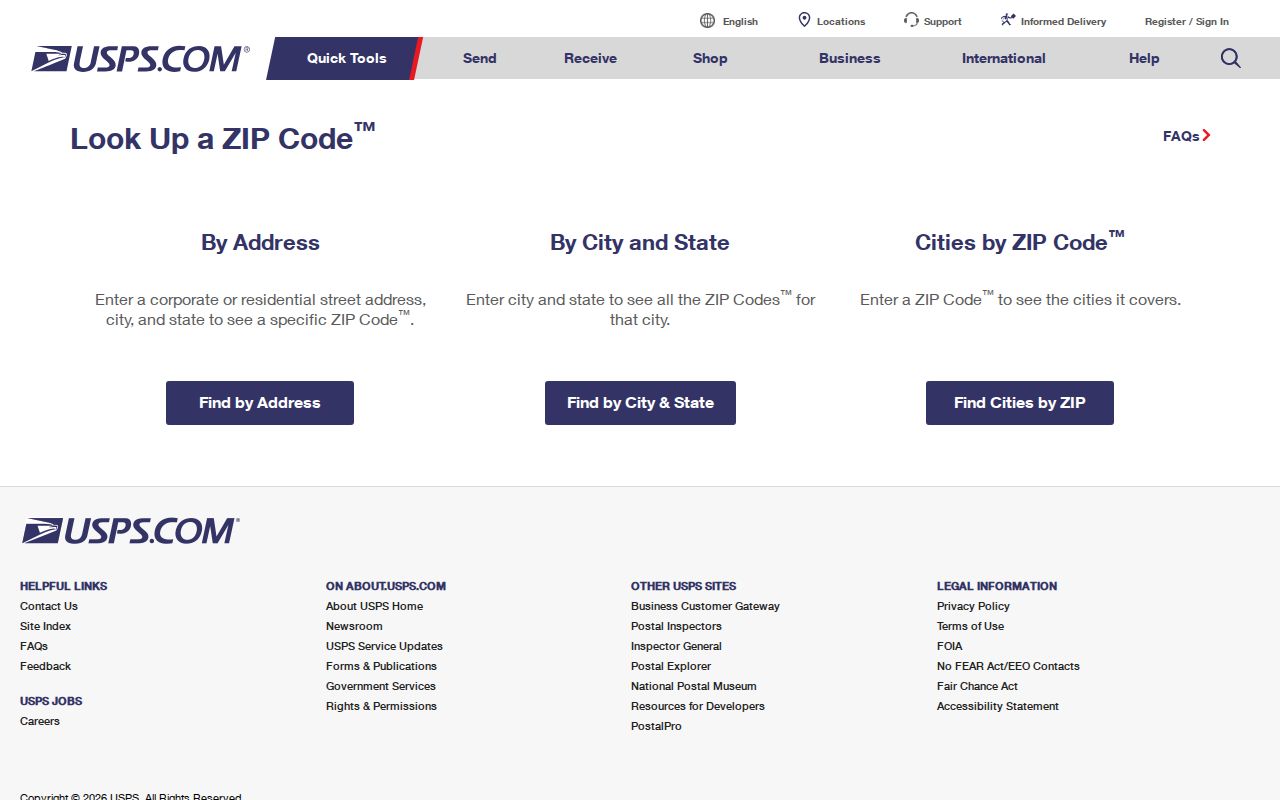
Use the By Address result when multiple postal possibilities appear. It verifies delivery formatting, not ownership, municipal status, or residence.
Bethany ZIP Postal Geography
USPS says ZIP codes do not necessarily follow municipal boundaries. That rule matters in Bethany, where an address with a Bethany city name can be outside incorporated limits, and a parcel inside the city can have a tax mailing address in another city or use a different postal pattern. Bethany is bordered by Warr Acres on the east and Lake Overholser and Stinchcomb Wildlife Refuge on the west, making edge assumptions especially risky.
Compare three sources before describing a location: USPS for the standardized delivery address, the Oklahoma County GIS viewer or ODOT map for city limits, and the assessor for the situs and legal parcel. A city name in one field cannot replace the other two. The research did not verify a complete historical ZIP split, realignment, or adjacent acceptable-city list, so an address-level check is the safe answer.
Bethany ZIP Postal Boundaries
Postal geography serves delivery. A ZIP is not a ward, school district, county, Census tract, or legal title boundary. Oklahoma House District 100 lists Bethany with 73008, 73099, 73122, 73132, and 73162, which is a clear local illustration of the difference. A political district’s ZIP list can help identify regional context, but it cannot prove postal service to a Bethany address.
- ZIP and ZIP+4
- A ZIP is the main delivery-routing code. ZIP+4 adds a smaller delivery segment for a more precise standardized address.
- PO Box ZIP
- A ZIP used for post-office boxes rather than a statement about every nearby street delivery route.
- Unique ZIP
- A code assigned to a single organization or high-volume receiver when USPS designates one.
- Carrier route
- A delivery sequence used by postal operations, not a municipal border or public resident list.
ZIP-only research should pause when the goal changes from mail routing to street ownership, a legal lot, or an incorporated boundary. Each requires its matching public record.
Note: A political-district ZIP list gives regional context but cannot replace a USPS result for Bethany delivery routing.
Finding Bethany ZIP Residents
No inspected Bethany property, map, voter, or permit portal supplied a public ZIP-wide resident result. The lawful and accurate method begins with USPS and then narrows to an address. The assessor form has address, owner, account, subdivision, map, deed, and occupant or building-name choices, but no captured ZIP field. GIS has owner, address, account, and intersection search modes, yet no verified ZIP filter. The voter portal requires first name, last name, and date of birth rather than a ZIP search.
- Use USPS By Address to standardize the full Bethany delivery address and preserve any unit line or ZIP+4.
- Search the resulting street address in the Oklahoma County assessor system to identify the situs, account, legal description, and recorded owner fields.
- Open the parcel in GIS to check city limits and parcel geometry, then compare the city result with the postal form.
- Use the County Clerk index for title records when ownership history or a legal-description check is needed. Do not infer a household from a ZIP alone.
Once the ZIP is narrowed to a street, the Bethany street directory gives the address-record sequence without treating postal delivery data as a household roster.
Bethany Portal ZIP Limits
The assessor’s wildcard street search returns assessor-indexed parcels, not a ZIP-wide postal list. The GIS map follows parcel and city-limit layers rather than delivery polygons. Citizenserve is a permit and application workflow with no captured public ZIP-wide result browser. The voter portal is a person-verification tool and the qualified EDW voter-file route is controlled by request rules and protected-record limits. USPS is the only researched official source that directly verifies delivery formatting at the individual address level.
That division protects against a common error: using one system’s geography as though it were another’s. A parcel map may establish a city line. A postal lookup may standardize delivery. A voter record may confirm registration for a known person under its rules. None converts into a complete ZIP population or current household list.
Note: Use the portal that matches the question, because postal, parcel, and registration systems index different facts and apply different access limits.
Bethany ZIP Address Keys
Four address terms often appear together but do not mean the same thing. The situs or physical address is the location used by the assessor, city permits, GIS, and navigation. The mailing address is where tax or official correspondence goes and may be remote from the parcel. The legal description, such as lot, block, subdivision, or section-township-range language, controls recorded title. The ZIP is USPS delivery routing.
For a Bethany property trail, save all four values. Start with the situs in the assessor search, take the account and legal description to OKCC.ONLINE, and compare the recorded information with the standardized USPS output. A mailing address can point to a tax contact but does not establish where an owner or other person lives. The legal description is the safer bridge when old and current street forms do not line up.
Note: Save the standardized address with its lookup date because postal delivery labels and parcel fields are maintained by different custodians.
Bethany District ZIP Overlap
Bethany’s relationship to surrounding places makes labels especially important. Oklahoma County District 2 includes Bethany, Warr Acres, Woodlawn Park, and parts of Oklahoma City. ODOT’s map places Bethany inside Oklahoma County, while a political district can include several communities and ZIPs. The House District 100 list is useful as a reminder that a political coverage list is broader than a postal one.
Route 66/39th Street is a major east-west Bethany spine, and city code wards use numbered NW streets and named north-south streets. These help orient an address on a local map. They do not change a delivery ZIP, create a city-limit ruling, or identify a resident. Compare the actual address in USPS and the parcel in GIS before attaching a municipal label.
Bethany ZIP 911 Addressing
Oklahoma’s 911 guidance says local authorities complete addressing and directs addressing questions to the state contact route for connection to the local authority. The adopted Address Standards 2.1 use a GIS-based NG911 framework. Bethany-specific current address assignment remains a municipal, county, or local GIS question, not a conclusion that can be drawn from a broad ZIP search.
For a disputed form, preserve the USPS standardized line, the assessor situs, the parcel legal description, and the map result. Those four records document different parts of the same place. Do not substitute one for another, especially near an edge where Bethany, Oklahoma City, Warr Acres, or western unincorporated geography can appear in adjacent records.